UgCS Drone Software - JBUAS Discount Code
SPH Engineering provide a number of invaluable software packages to enable safe, effective, and efficient flight missions. If you’re thinking of buying UgCS software to support your missions with or without a sensor, take advantage of our coupon code [JBPRMUGCS] to get a significant discount over online UgCS prices.

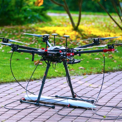
UgCS EXPERT & LIDAR360
This bundle of UgCS EXPERT in combination with LIDAR360 Framework gives you all the tools you need for getting started with LiDAR data collection and processing. Classify point clouds, generate accurate 3D models using UgCS in combination with LiDAR360.
The LiDAR360 Framework lays the foundation for the entire software suite. With TB-level processing power, the Framework contains tools required for effectively interacting and manipulating LiDAR point cloud data. Functions include data management, automatic strip alignment, and point cloud classification.
It also allows users to upgrade to application-specific modules such as terrain, ALS/ TLS Forestry, and Mining.
In the latest version 5.0, the powerline module is added to LiDAR360. Users can conduct professional analysis on powerline data, such as classification, danger point detection, and so on.
Link to UgCS in a separate window

LIDAR 360
LiDAR360 is a professional processing platform for massive point cloud data. The platform employs over ten different types of international leading point cloud algorithms, artificial intelligence, and machine learning to promote the use of LiDAR across the industry and solve users’ application problems while unlocking the full potential of their pointcloud data. The software can analyze and process massive point cloud data, adapts to multiple platforms
and devices, and provides more than 700 functions for efficient support of multi-industry applications.
LiDAR360 is used actively in more than 130 countries and regions, receiving an array of praise from clients, contractors, governments as well as tertiary and research institutions.
Platform Features
- Preprocessing: Solving calibration error, trajectory error and laser sensor error to correcting layered point cloud. Providing hybrid adjustment for multi-source data. Supporting correction by control points and quality inspection.
- UAV Processing: One-click operation for UAV point cloud&image process, fully improve ALS data quality.
- Classification: Auto-Classification for various features by deep learning. Support AI training for point cloud calssification.
- Editor: Provide efficient editor tools for point cloud, model, vector and raster, link multi-source data for identification.
- Vectorization: Rich semi-automatic editing tools for 2D/3D vectorization by multi-source data, seamless CAD and GIS data aggregation.
Link to LIDAR360 in a separate window