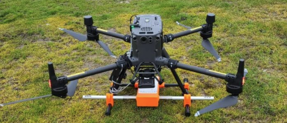


UgCS SkyHub 3 TTF Core Integration (The Core System)
The UgCS SkyHub 3 solution is a hardware and software set designed to enhance UAV capabilities for commercial surveying and inspection purposes. In essence, it is the onboard computer that is at the heart of your UGCs drone-based geophysical sensor system. Watch a video on setting up UgCS SkyHub and TTF on an M300 RTK with a SENSYS R4 Magnetomer here.
Payloads – DJI M400
Due to the different design of the M400 drone compared to the older M350, there have been ongoing payload configurations underway, and we are pleased to say that the majority of the sensors are now available for the M400. However, some integrations are still work in progress; e.g., SENSYS R3/R4 magnetometer systems will continue to be available for M350 RTK until the new attachment design is available.
Our test centre is available for any testing that might be required. Visit the JBUAS TTC.
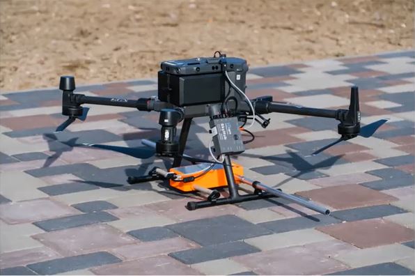
The Core System (and GPR payload)
The role of UgCS SkyHub:
- To collect and store data acquired by an onboard sensor with altitude radar.
- To convert and record data (including geotagging) in a format convenient for processing
- To provide numerous types of file types for download to processing and analysis software
- To communicate with the drone flight controller to acquire flight parameters
- To implement custom flight control algorithms
- To provide extended UAV diagnostics
UgCS SkyHub is currently fully compatible with the following DJI drones: M300RTK, M350RTK, and M400. There is also support for any drone utilising the DJI A3 and PixHawk Arducopter controller.
SkyHub Support Packs
From January 2025, SPH Engineering launched the SkyHub Support scheme. This scheme means that users will need to purchase an annual SkyHub support pack starting from year 2. Therefore, when a user buys a SkyHub integrated sensor system, the SkyHub Support for the first year is included. At the current time, access to the SkyHub software updates (Custom Payload Monitor and SkyHub firmware) remains free of charge for all users.
As SkyHub 2 is no longer supported, this scheme only concerns SkyHub 3 units and future SkyHub models. If you have owned a SkyHub for more than 1 year, you will be required to purchase a support pack to continue to receive:
• Personalised Assistance: Email, phone, or video conferencing support during business hours
• Minimised Downtime: Fast resolutions to technical challenges
• Continuous Expertise: Access to our knowledgeable team for your specific needs
ATTENTION: Since January 31, 2025, SPH Engineering no longer processed support enquiries for SkyHub systems without an active support pack. Nevertheless, JBUAS continues to provide basic troubleshooting to customers – this excludes firmware licence updates that require direct SPH involvement.
Get in touch to purchase/renew your SkyHub Support Pack.
UgCS True Terrain Following (UgCS TTF)
Using the UgCS SkyHub in combination with the Nano Radar NA24 or newer USD1 Radar, any compatible drone can fly at a set AGL (in TTF Mode), depending on the need of the onboard sensor. For example, for Ground Penetrating Radar (GPR), the drone can fly at 0.6 m AGL, or for methane measurement missions, the drone may fly at 30 m AGL. As well as TTF, the user may also activate a Hop Mode. This enables the drone to dip, return to position, and fly to the next waypoint to repeat the sequence. This feature is especially useful for conducting hydrography surveys.
Firmware Licence Requirements
To enable True Terrain Following (TTF) through SkyHub, there is a requirement for the user to purchase a TTF firmware licence. This firmware licence will be programmed into the SkyHub via an upload of a licence file during the installation of the Custom Payload Monitor (CPM) interface. Look further down the page for more information on the CPM and its purpose.
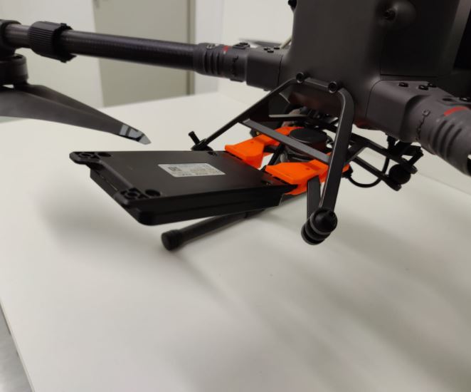
Radar for Enabling TTF
UgCS Obstacle Detection Radar (UgCS ODR)
Using the UgCS SkyHub in combination with the UgCS ODR gives the pilot extra protection against unwanted accidents that can happen during routine sensor missions. The ODR works with the existing UgCS radar altimeter on the M300 RTK or M350 RTK to provide users with extra peace of mind when flying geophysical sensor missions. The ODR is a brilliant addition to UgCS SkyHub’s list of supported sensors and, like the radar altimeter, has an easy, quick connection.
This system can be used with True Terrain-Following, or TTF, mode (when the radar altimeter is used to ensure a constant elevation over the ground), and in normal autopilot missions. The ODR is also extremely useful for magnetic surveys when digital elevation models (DEM) are used for mission planning, where the possibility to catch the edges of tree branches or parts of other protruding features remains a risk.
The ODR is available as standard for both M300 RTK and M350 RTK drones. Please get in touch to find out more.
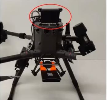
M300RTK/350RTK ODR Configuration
Compatible Survey & Inspection UgCS Sensors
SPH Engineering provides various kits to cater to customers’ project needs. In addition, the UgCS SkyHub treats the Nano Radar as a separate sensor. Available altitude sensors for drone kits are listed below; see more information on UgCS sensor kits.
- UgCS True Terrain Following (UgCS TTF) kit
- UgCS Ground Penetrating Radar (includes UgCS TTF kit)
- UgCS Methane Mapping Laser (with or without TTF kit)
- UgCS Echosounder / UgCS Bathymetry System (includes TTF kit)
- UgCS SENSYS R1 Magnetometer System (with/without TTF kit)
The keen eye will notice that we speak about a specific SENSYS R1 kit for magnetometers. This is because data for all but one of the magnetometers (SENSYS R3, SENSYS R4 and Geomatrix MagArrow 2) are stored within the respective magnetometer’s recorders. Despite this, UgCS has a number of extra options that link UgCS SkyHub to the SENSYS R3 and R4 sensors, providing some innovative shortcuts both for data and power. The kits noted above include the UgCS SkyHub computer, cables, and related UgCS software. One may extend the capabilities of the UgCS SkyHub by adding custom payloads. Get in touch to talk about custom payloads.
Useful Specifications and Features
The UgCS SkyHub is easily connected to any compatible drone for communications and power in seconds. With 3D-printed clips (see the UgCS Parts Library), mechanical fixing is quick and simple to perform. It provides options for sensor power and data using reliable and robust connectors, making them ideal for airborne applications. It provides safety features for both input and output power and provides fully isolated and ESD-protected external interfaces.
Specifications include:
- 64GB of onboard memory
- Operating range: -25°C to +85°C
- Selectable Power Sensor Output (9/12/15/18V)
- WiFi & Bluetooth enabled
- Compact Size
- Lightweight (195 g)
The UgCS SkyHub 3 has endless connectivity for sensors: 3 x UART & GPIO, 1 x UART & RS-232, 1 x RS-232 & GPIO, and 2 x USB. Communication is also possible using Ethernet and both the Wi-Fi and Bluetooth methods.
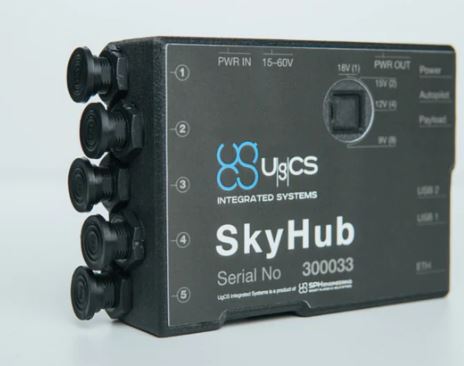
Example: SkyHub 3 Port Flexibility
SkyHub: Offline Data Storage Keeps Mission Data Safe
Organisations using drones for geophysical surveying (GPR, magnetometers, echo sounders, and FDEM) need confidence that their collected data remains secure. SkyHub, the onboard computer developed by SPH Engineering, is designed with offline data storage and onboard initial processing, giving operators full control over how data is stored and transferred.
SkyHub enables the integration of external sensors and payloads with UAVs for applications involving archaeology, geology, geography, UXO clearance, utility detection, and even bathymetry studies. One of SkyHub’s key features is that it does not transfer any geophysical sensor data to the drone or allow for cloud contamination.
The SkyHub does not rely on cloud-based storage and is therefore practically ‘locked down’. The data recorded is sent directly on the onboard computer and can later be downloaded to an operator-controlled system. All the data also moves through preliminary processing, meaning data is formatted in standard formats for use by well-established processing packages.
Because SkyHub doesn’t use cloud data, it reduces the risk of cyber-attacks, unauthorised access, and data exposure during transmission. For organisations that handle sensitive information, SkyHub provides a secure approach to drone data management while supporting confidentiality, compliance, and data quality.
Custom Payload Monitor (CPM)
As seen above in the side-by-side laptop screen grab, the CPM interface is showing configuration for a GPR survey. Here we can see all of the sensors attached: the TTF radar enabling a constant Xm AGL, an Obstacle Detection Radar (ODR) to mitigate collisions, and the GPR for recording the ground survey.
Downloading Data for Processing
Right, the CPM download screen is displayed. It is through the CPM interface that we are provided with a choice of file types to download for post-mission processing and analysis in such software as Prism 2, Pergam Gas Analyser, SENSYS DataTool, or HydroMagic, to name but a few. The user can decide to download all of the flown files or only the survey files for the present day. It is a simple tick-box exercise that makes selecting the right files quick and simple.
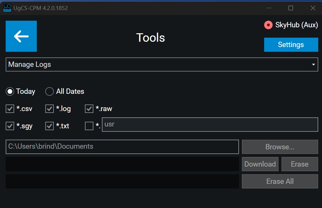
The CPM data download screen
Comprehensive Training on the Software Integration
There are three items of software that users need to operate a UgCS drone sensor system.
- UgCS (the route planner)
- The UgCS companion app (installed on an RC)
- The UgCS Custom Payload Monitor (CPM).
The CPM is the clever software that integrates with UgCS and enables the sensor payloads to be managed effortlessly by the flyer. It is the CPM that enables the user to access the features of the UgCS SkyHub onboard computer.
Get Peace of Mind at the Test & Training Centre
Chill – there’s no need to worry! When you purchase a sensor system from JBUAS, you are guided through the complete integration. Furthermore, during our standard training programme, you are taught how to install, operate, and get the best from using CPM. If you’re lucky enough to undertake your training at the Test and Training Centre, you can enjoy flying time to appreciate how to confidently fly your new system under the supervision of the systems specialist.
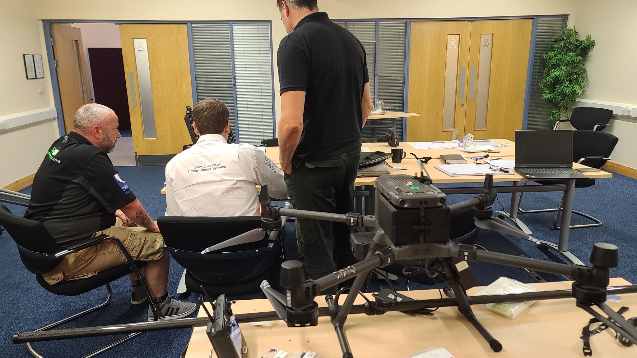
Theory and practical training in one place – The UK Test and Training Centre
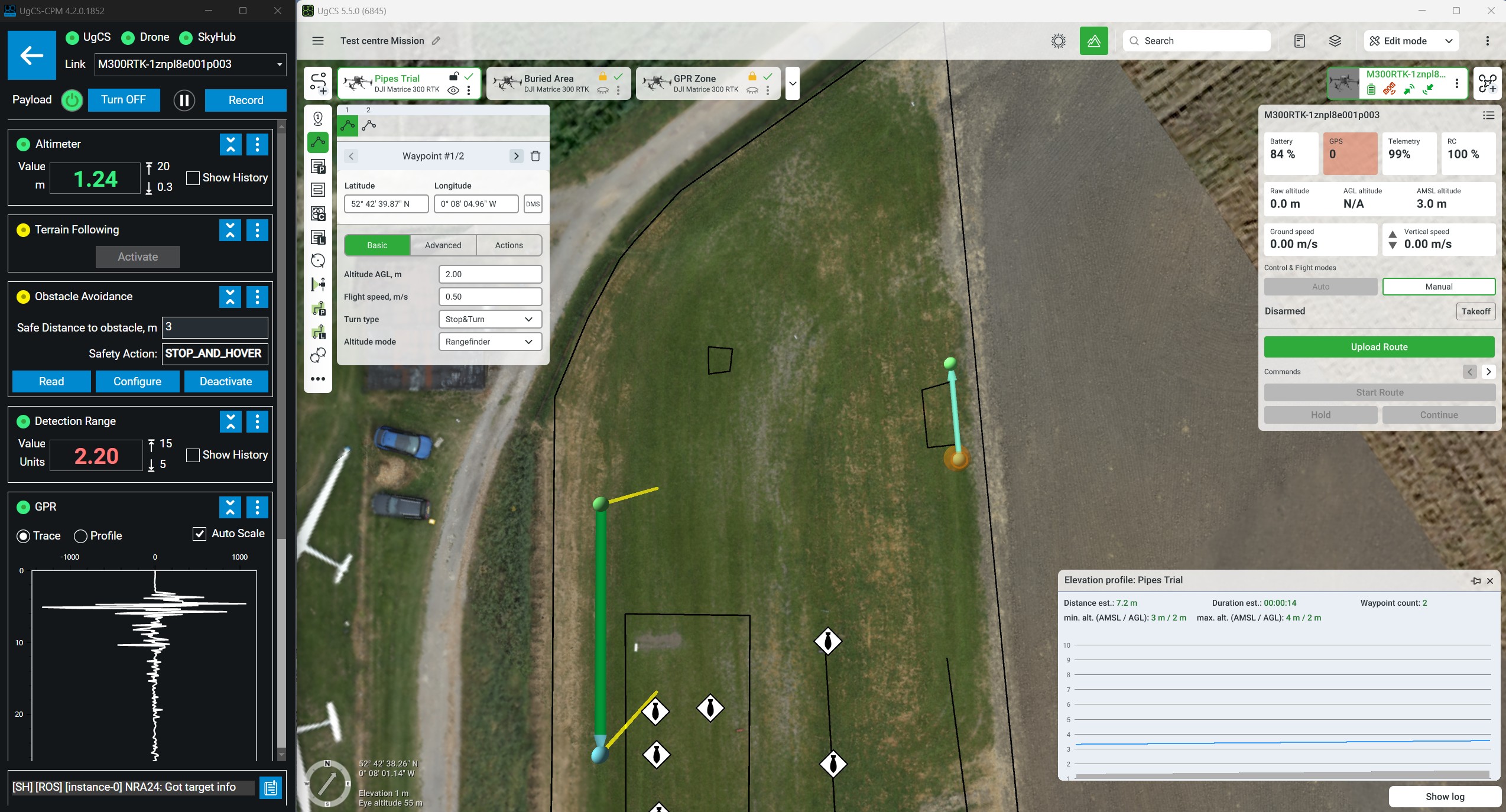
Side-by-Side: Custom Payload Monitor & UgCS