Drone Bathymetry
Drone Bathymetry is the act of using a drone and a sonar to measure (map) the depth of water in oceans, rivers, or lakes. Bathymetric maps look a lot like topographic maps, which use lines to show the shape and elevation of land features. On topographic maps, the lines connect points of equal elevation. On bathymetric maps, they connect points of equal depth.
Drone Echo sounders are used to make bathymetric maps. An echo sounder sends out a sound pulse from just below the water surface, to the ocean floor. The sound wave bounces back to the echo sounder. The time it takes for the pulse to leave and return to the echosounder determines the bathymetry of the seafloor. The longer it takes, the deeper the water.
Drone Echo sounders
An echo sounder can measure a small area of the fresh waterbed or seabed. However, the accuracy of these measurements is still limited. The echo sounder from which the measurements are taken is moving as the drone moves above the water, changing the depth to the bed by possibly centimetres. The speed of sound in water also varies, depending on the temperature, salinity (saltiness), and pressure of the water. In general, sound travels faster as temperature, salinity, and pressure increase. For further information on echo sounders and their uses, please see here.

UgCS Drone Bathymetry
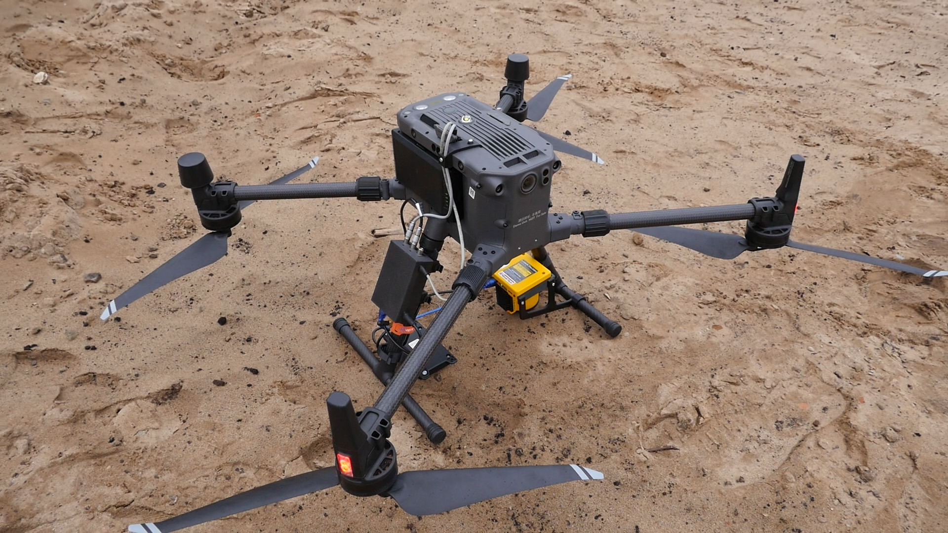
Luckily, UgCS provide a comprehensive range of hydrography options that can support effective bathymetric mapping surveys using echo sounders. As well as two echo sounders (single and double frequency), UgCS can also supply salinity, tubidity, flow speed, and sound velocity sensors.
Benefits of Drone Bathymetry
There are several good reasons why airborne deployment of hydrography sensors is a good idea:
- Small and/or shallow
- Hard to reach locations/no points of entry
- Seaweed, debris, mechanical pollution (Grasshop.)
- Drinking Water reservoirs (no boats)
- Fast set-up, easy deployment
- Good repeatability
- Excellent maneuverability
Drone Echo sounder Applications
- River Channel Depth Mapping (Single/Duel)
- Waterway Scour Identification (Single/Duel)
- Submerged Debris location (Single/Duel)
- Soft Sediment Depth Indications (Duel)
- Fresh water reservoir surveys (Single/Duel)
- Support primary Sensor surveys (Single/Duel)

UgCS Echosounder Options
- Single Frequency (450KHz) & Temperature
- 0.3m to 100m Depth (Practical use >30cm)
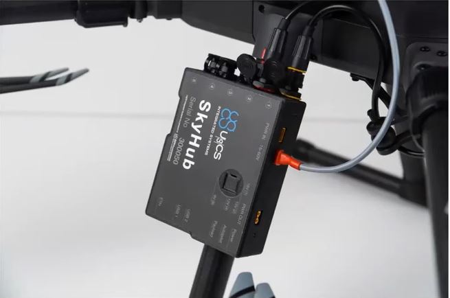
- Connects directly to SkyHub
- Tilt sensor provides SkyHub with quality control
- Kit weight ~1.3Kg
- Two modes: standard NMEA (O803) and Full Echo data
- CSV for X,Y,Z. SEG-Y for HydroMagic software
- Dual Frequency (50KHz and 200KHz) & Temperature
- 1.3m to 200m Depth. Soft sediment layer thickness/penetrates submerged veg.
- Connects directly to SkyHub
- Tilt sensor provides SkyHub with quality control
- Kit weight ~2.3Kg
- Two modes: standard NMEA (O803) and Full Echo data
- CSV for X,Y,Z. SEG-Y for HydroMagic software

For further information, get in touch.