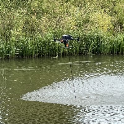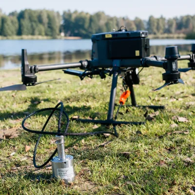





EchoLogger ECT D052S (SBES) Echosounder

EchoLogger ECT D052S (SBES) Echosounder

  • A compact, high-performance dual-beam echosounder designed for bathymetric surveying and depth measurement
  • Provides reliable depth data for inland, coastal, and environmental survey applications
  • Used for assessing the depth of water and soft sediments beneath the channel bed
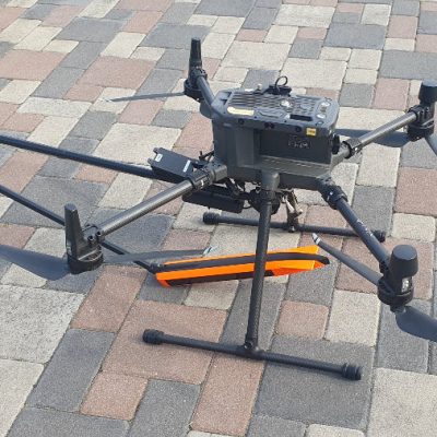
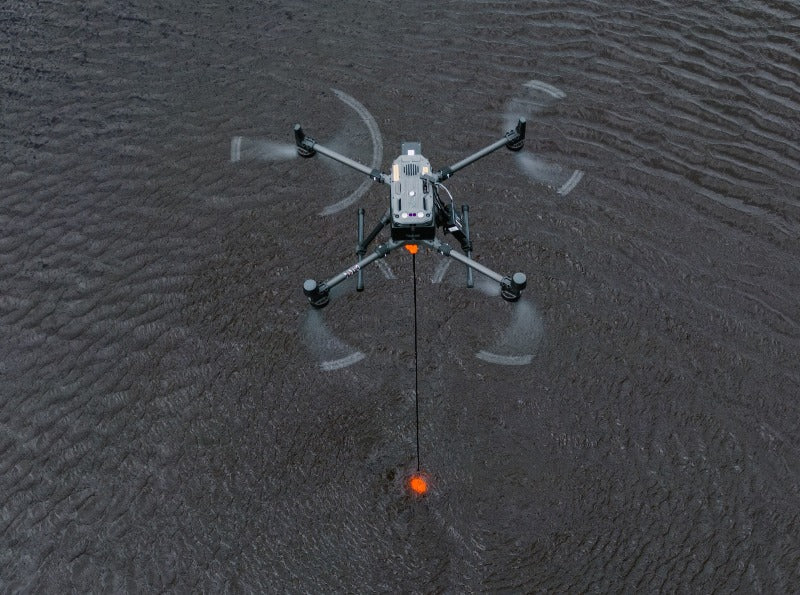
  • Commonly deployed with DJI M400, M300 RTK/M350 RTK and other UAV platforms

Enquiry

UgCS D052S DF (SBES) Echosounder System

Advanced Dual-Frequency Bathymetric Surveying for UAV Operations

The UgCS D052S DF Echosounder System is a high-performance dual-frequency single-beam echosounder (SBES) designed for accurate bathymetric surveying, hydrographic mapping, and sediment monitoring. Integrated with the SPH Engineering UgCS SkyHub ecosystem, the system enables drone operators to collect precise georeferenced depth data in environments that are difficult, hazardous, or costly to survey using conventional vessel-based methods.

Featuring both 50 kHz and 200 kHz acoustic frequencies, the system provides flexible surveying capability across a wide range of water conditions. The lower-frequency channel supports penetration into soft sediment layers, while the higher-frequency channel delivers highly accurate depth measurements for bathymetric mapping and infrastructure inspections.

Optimised for deployment with DJI M400, 300 RTK and M350 RTK platforms, the system provides a safe, efficient, and cost-effective solution for hydrographic and environmental survey operations.

What’s Included

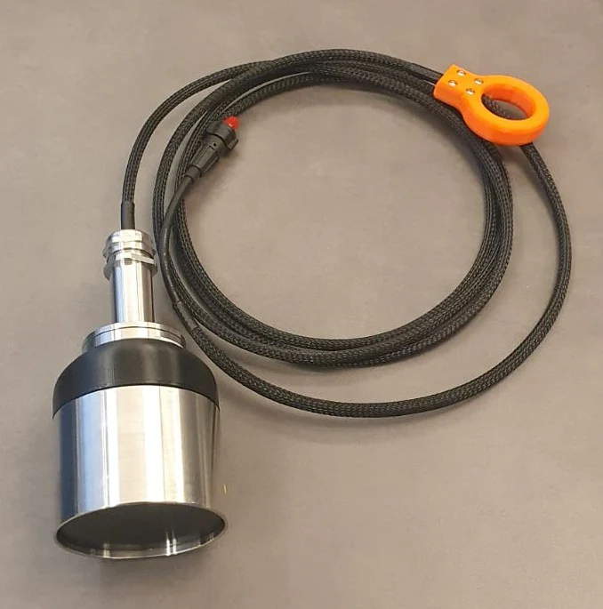
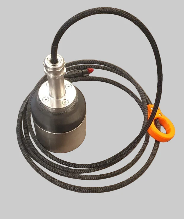
  • EchoLogger ECT D052S Dual-Frequency Echosounder
  • Integrated Tilt and Temperature Sensors
  • Protective Housing and Suspension Assembly
  • UgCS SkyHub Integration Interface
  • Data and Power Connection Cables
  • Mounting Hardware
  • Transport and Storage Case
  • User Documentation and Setup Guides

Key Technical Specifications

  • Sensor Type: Dual-Frequency, Single Beam Echosounder (SBES)
  • Operating Frequency: 50 kHz / 200 kHz
  • Measurement Range: 1–200 m (50 kHz), 0.5–200 m (200 kHz)
  • Beam Width: 27° / 7° Conical (-3 dB)
  • Range Resolution: up to 1.0 mm
  • Accuracy: 2% of measured depth
  • Sediment Detection Capability: Supports sediment differentiation via dual-frequency operation
  • Integrated sensors: Tilt/Roll Sensor, Temperature Sensor
  • Output Formats: CSV, NMEA-0183, SEG-Y Compatible
  • Interface: RS232
  • Compatible UAV Platforms: DJI M400, M300 RTK, M350 RTK, and other supported UAVs

EchoLogger ECT D052S (SBES) Echosounder

  • Dual-Frequency Survey Capability: The combination of 50 kHz and 200 kHz frequencies provides flexibility for both standard bathymetric mapping and sediment analysis applications. Operators can optimise surveys according to water conditions and project requirements.
  • High-Accuracy Depth Measurement: With millimetre-level range resolution and a depth accuracy of 0.2% of measured depth, the system delivers reliable bathymetric data for professional hydrographic and engineering applications.
  • Sediment Layer Detection: The lower-frequency 50 kHz channel can provide improved detection of soft bottom materials, supporting sediment monitoring, dredging assessment, and tailings facility management.
  • Integrated Motion and Environmental Sensors: Built-in tilt and temperature sensors help improve data quality and provide additional environmental information during survey operations.
  • Real-Time Georeferenced Data Collection: UgCS SkyHub synchronises depth measurements with UAV positioning data, enabling accurate georeferenced bathymetric outputs and streamlined post-processing workflows.
  • Enhanced Operational Safety: Drone deployment eliminates the need for survey vessels in many shallow, hazardous, contaminated, or difficult-to-access environments, reducing operational risk while improving efficiency.
  • Rapid Deployment and Survey Efficiency: The lightweight airborne system can be operational within minutes, enabling rapid data collection across large survey areas and reducing field time compared with traditional methods.
  • Seamless UAV Integration: Designed for integration with DJI M300 RTK and M350 RTK platforms, the system works within existing UgCS mission planning and survey workflows.

A Single Beam Echosounder (SBES) measures depth directly below the sensor using an individual acoustic beam. A Multibeam Echosounder (MBES) produces multiple acoustic measurements across a wider swath, generating much greater data density. An SBES such as the ECT D052S can therefore be a more compact and cost-effective solution for targeted depth measurements and survey lines, while an MBES is better suited to high-density area-wide seabed mapping.

JBUAS offers reliable domestic and international shipping through DHL. All deliveries are fully tracked and insured to ensure peace of mind from dispatch to arrival.

UK Delivery

  • In‑stock items: Delivered within 2-3 working days
  • Next Day Delivery: Available to many UK mainland addresses
  • Non‑stock items: Delivered within 4-5 weeks

International Delivery

As a proud member of the Chartered Institute of Export & International Trade, JBUAS is a trusted supplier of drones and sensors to global markets. International orders are fulfilled via DHL, with delivery available across Europe and worldwide to business customers.

UgCS sensors such as the EchoLogger ECT D052S (SBES) Echosounder are capable of being employed across a variety of sectors:

Waste (landfill) and Water Treatment

Water and Flood Management

Construction

Power and Energy

Archaeology

Mining and Quarrying

Top