High Precision with Affordability
Topodrone (Switzerland) design and manufacture affordable high-precision solutions for aerial surveys.
Their lidar solutions include:
- Lidar
- Lidar & Photogrammetry integrated
Lidar 200+
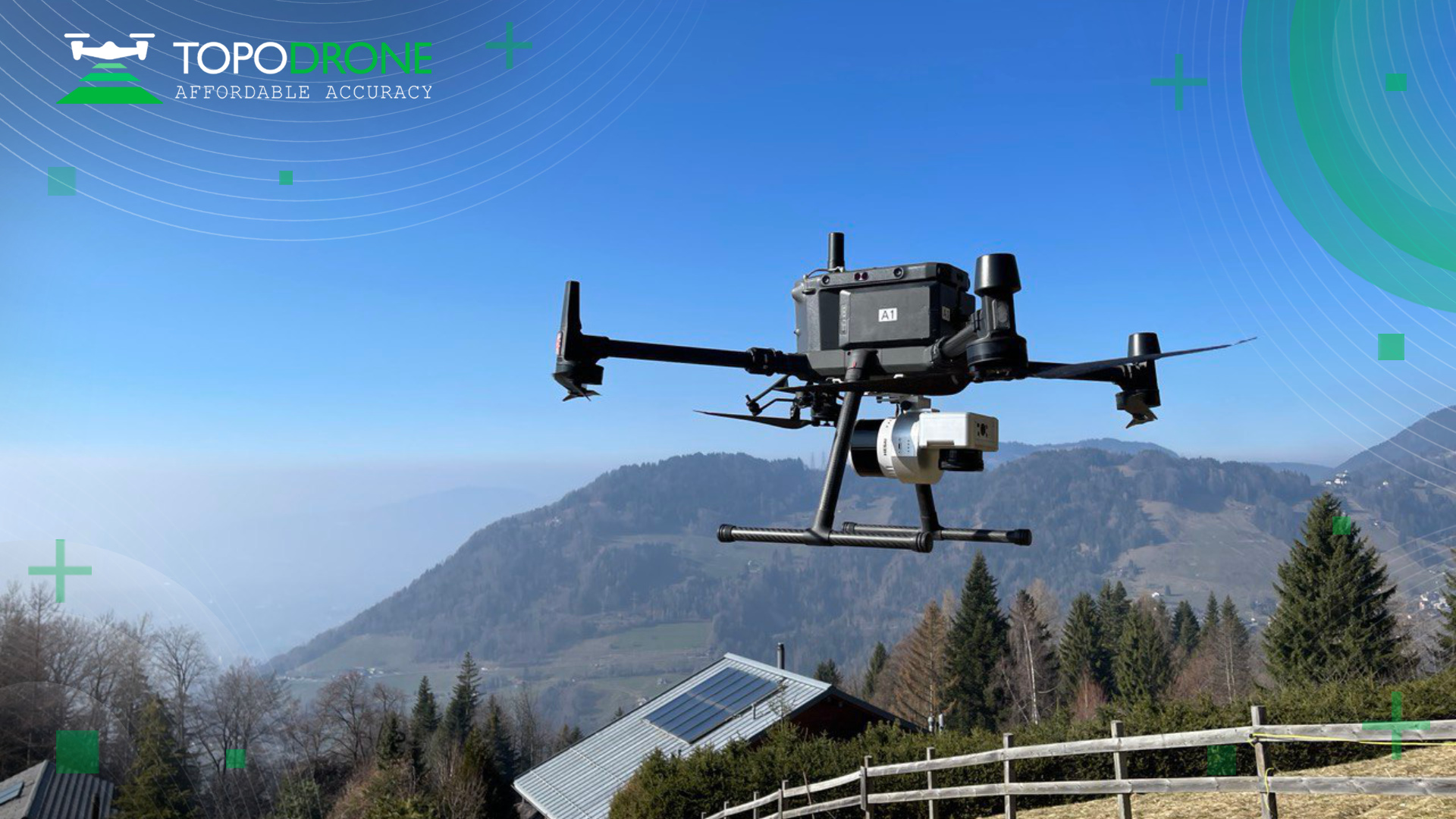
The Topodrone lidar solutions are simply connected through Skyport for M300 and M350RTK. Taking only a few minutes to attach, the lidar is ready for deployment quickly. All the wiring and attachments are included in this solution. For none M300/M350RTK drones, the Topodrone lidar solutions come with an integrated PPK module within the lidar body with a PPK antenna attached to the top of the drone.
UgCS Expert Lidar Toolset
The lidar 200+ solution is fully compatible with UgCS Expert. UgCS Expert is the leading lidar mission control software and is a proven solution for both experienced and new lidar survey pilots. Find out more about UgCS Expert here.
Photogrammetry (Topodrone P61 Camera)
The P61 is a professional modified camera with Topodrone Lidar 200+ integration support. The P61 has a 61 MP resolution, it has a full frame sensor and a mechanical shutter, and has a pleasing ISO of 100-25600 enabling a wide range of flexible light adjustment. The P61 also comes as standard with a 24 mm lens yet only weighs 0.45kg.
Get 3cm accuracy without GCP: Topodrone offer a ‘ready-to-survey’ GNSS receiver solution that connects to their modified and calibrated camera. This provides pilots with a high accuracy of photogrammetry data up to 3cm accuracy in the XYZ without using ground control points (GCP).
Ready-to-fly industrial RTK/PPK solutions.
A built-in survey grade L1/L2 Multi-band RTK/PPK GNSS receiver connected via an advanced synchronization system with their camera turns any suitable drone into professional survey tool. You can capture aerial photos with up to 1 cm resolution per pixel and easily transform them into high accurate orthomosaic and 3D models in automatic mode.
Full training for every solution
We provide training in flight and data processing for both experienced users and those who are planning to use unmanned technology for the first time in their work.
Lidar Solutions
Most Compact 360° Lidar
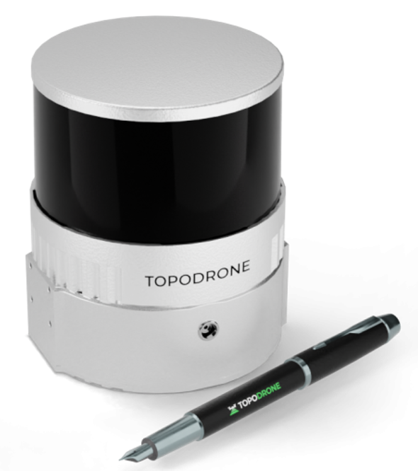
Topodrone Lidar 200+
This laser scanner is based on the Hesai XT32M2X with a 300m working range, a 200m working flight altitude, a triple return mode up to 1,920,000 points per second, a 3-5 cm XYZ accuracy, a 360° FOV, a built-in 200 Hz IMU with 0.07/0.01 accuracy, and a built-in GNSS receiver.
The lidar 200+ is:
- The most compact 360° lidar on the market.
- The lightest lidar of the product line – 0.8kg
- The highest working flight altitude – 200m.
- Triple return mode: Single (640,000 PPS), Double (1,250,000 PPS)
- Highest scanning frequency in class – Triple (1,920,000 PPS)
Advanced Features
- Affordability: Aimed to be the lowest prices for lidar in its class.
- Performance: It can survey over 2 square km of territory in one flight from a 200m altitude
- Accuracy: Very precise and thin point cloud due to modern laser sensor, built-in high precision IMU and integrated GNSS receiver.
- Mobility: It is a 3 in 1 lidar: it can be mounted not only on a drone, but also on a car or even a surveying backpack.
- Autonomy: Completely autonomous lidar missions when mounted on the DJI Matrice 300RTK or M350RTK.
- Software: Provides full processing cycle from trajectory calculation to point cloud generation with the required coordinate system, strip adjustment and SLAM algorithms for data processing in conditions of insufficient GNSS signal are supported.
- Integration: The laser scanner can work on any drone and is fully compatible with the TOPODRONE P61 photogrammetric camera. The P61 camera can be connected to the lidar 200+, giving options for both a fixed installation or on a 3-axis gimbal.
What’s in the box?
1 x TOPODRONE lidar 200+
1 x Drone mount
1 x Antenna cable
1 x GNSS antenna
1 x Flash card
1 x Cable kit
1 x Carrying case
To make an enquiry for this market leading lidar, please get in touch here.
