



SPH Engineering’s TTF Radar and Drone Integration
Why True Terrain Following radar is now essential for UK geophysical, environmental and industrial drone operations.
Low-altitude UAV flight is where the most valuable survey data is collected — but also where the risks multiply. Magnetometers, GPR, methane sensors, echo sounders and other specialist payloads all require flight profiles just metres above the ground or water surface. At these altitudes, relying on barometric height or basic OEM terrain awareness is not enough.
SPH Engineering’s True Terrain Following radar (TTF) has become the industry standard for safe, automated low-altitude flight in the UK. Integrated through SkyHub and controlled via UgCS, it enables drones to maintain a constant height above ground or water — even in steep, uneven or hazardous environments. As SPH Engineering’s UK integration partner, JBUAS delivers fully configured TTF-enabled systems, training, and real-world demonstrations at its Test & Training Centre.
What True Terrain Following Radar Actually Does
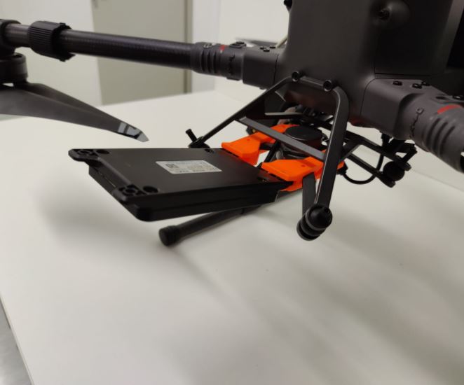
SPH Engineering’s True Terrain Following Radar
The True Terrain Following radar provides real-time altitude correction, allowing drones to maintain a constant height above ground or water — even in complex terrain, steep embankments, woodland edges, landfill cells, or uneven industrial sites. This is the core function: continuous, automatic altitude adjustment, independent of DJI’s barometric system.
Key capabilities of True Terrain Following Radar:
- Constant AGL height for geophysical payloads
- Safe methane mapping over hazardous industrial zones
- Stable altitude for bathymetry over uneven water surfaces
- Protection against barometric drift
- Fully offline operation
Why Low-Altitude Flight Is Difficult Without TTF
Barometric drift
DJI aircraft maintain height relative to the take-off point, not the terrain. Over a 2 km corridor, this can create altitude errors of ±10–20 m, making geophysical data unreliable and potentially unusable.
Terrain complexity
Landfills, pipeline corridors, heritage sites and industrial plants all contain sudden elevation changes, vegetation obstacles, steep slopes and restricted-access zones. Without True Terrain Following radar, maintaining safe, consistent altitude across these environments is extremely challenging.
Sensor accuracy
Magnetometers, GPR and methane sensors all require stable altitude to maintain data quality. As described in the UgCS guide:
– SPH Engineering UgCS for UK surveyors — complete guide
How TTF Works with SkyHub
SkyHub is the onboard computer that synchronises sensor data with flight telemetry. It also acts as the processing layer for True Terrain Following radar.
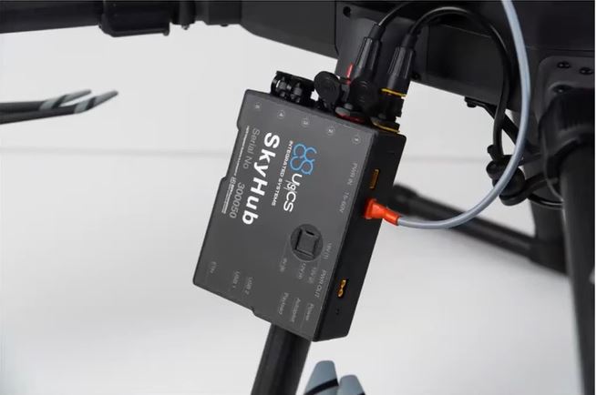
SPH Engineering – UgCS SkyHub
Sensor data is recorded in SkyHub, where it is combined with drone telemetry. SkyHub then automatically geotags measurements with accurate location and time information, ensuring all data can be precisely mapped and analysed after the flight.
TTF + SkyHub workflow
- Radar measures real-time distance to the ground or water
- SkyHub processes the altitude signal and feeds it to the flight controller
- UgCS adjusts the flight path automatically to maintain target altitude
- Sensor data is synchronised with corrected altitude and drone telemetry
- All mission data is stored offline for secure post-processing and analysis.
– SPH Engineering
UgCS: The Ground-Control Layer That Makes TTF Possible
UgCS (Universal Ground Control Software) is the mission-planning platform that fully supports SPH Engineering’s True Terrain Following radar. It provides terrain-aware planning, corridor mapping and low-altitude mission control for complex commercial UAV operations.
UgCS offers:
- Terrain-aware mission planning using DSM/DTM and elevation models
- Corridor mapping for pipelines, utilities and transport routes
- Low-altitude geophysical sweeps
- Bathymetry transects
- Offline planning for secure and regulated sites
True Terrain Following radar enhances these workflows by providing real-time correction, not just pre-planned elevation following.
Where TTF Radar Is Used in the UK
Geophysical Surveys (Magnetometry, GPR, EM)
Low-altitude grids for magnetometry, GPR and EM surveys require altitude stability within a narrow tolerance. True Terrain Following radar ensures a consistent sensor-to-ground distance across uneven terrain, improving data quality and repeatability.
– How JBUAS and SPH Engineering Are Transforming UAV-Based Geophysics in the UK
Methane & Environmental Gas Mapping
Methane plume detection requires stable altitude for accurate column-density measurement. TTF radar allows drones to fly safely over hazardous industrial assets while maintaining the correct height for gas sensors.
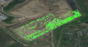
Methane Plume
For more detail on methane workflows, see SPH Engineering Methane Detection: UK Industrial Applications.
Landfill Gas-Emission Audits
Landfills contain steep slopes, capped cells and unstable ground. True Terrain Following radar allows drones to fly low over these areas without putting personnel at risk while capturing high-resolution gas-emission data.
Pipeline & Utility Corridor Mapping
TTF radar enables long linear missions with constant altitude, essential for leak detection and infrastructure inspection along buried gas trunk lines, powerlines and water networks.
– SPH Engineering Methane Detection: UK Industrial Applications
Bathymetry & Water-Body Surveys
Echo sounders require stable altitude above water to maintain consistent depth measurements. True Terrain Following radar provides the necessary altitude control over rivers, reservoirs and coastal waters, where barometric systems alone are insufficient.
Why TTF Radar Is Now a UK Industry Standard
Safety
True Terrain Following radar prevents altitude drop-outs that could cause sensor strikes, aircraft loss or unsafe proximity to structures and terrain. It reduces pilot workload and supports fully automated missions in complex environments.
Data quality
Stable altitude leads to stable sensor readings and reliable outputs. For geophysical, methane and bathymetry workflows, this directly improves interpretation and reporting.
Regulatory compliance
TTF radar supports UK regulatory requirements including Environment Agency methane reporting, heritage site surveying, utility corridor inspections and offline data security for sensitive sites, especially when combined with SkyHub’s offline recording.
Operational efficiency
By automating altitude control, True Terrain Following radar allows survey teams to focus on mission objectives and data quality rather than manual height management, reducing risk and increasing productivity.
JBUAS: The UK Centre for TTF-Enabled Systems
JBUAS is SPH Engineering’s UK integration partner, delivering advanced True Terrain Following radar systems for commercial surveyors, utilities, environmental consultants and industrial operators.
JBUAS provides:
- Fully integrated TTF + SkyHub + UgCS survey platforms
- Real-world demonstrations at the 7,500 m² Test & Trial Centre
- Sensor-specific workflows for magnetometry, GPR, methane and bathymetry
- Local technical support, calibration and mission-planning guidance
- Compliance and data security advice for regulated UK sites
– How JBUAS and SPH Engineering Are Transforming UAV-Based Geophysics in the UK
Final Takeaway
SPH Engineering’s True Terrain Following radar is not an optional add-on — it is the foundation of safe, accurate, low-altitude UAV surveying in the UK. Combined with SkyHub’s offline data security and UgCS’s terrain-aware mission planning, TTF enables surveyors to operate confidently in complex, hazardous and regulated environments.
JBUAS provides the UK’s most advanced TTF-enabled systems, training and real-world testing, ensuring organisations can deploy these capabilities immediately and safely across geophysical, methane, bathymetry and industrial workflows.
Related Reading (Cluster Articles)
- What is SPH Engineering’s SkyHub, and how does it work?
- SPH Engineering UgCS for UK surveyors — complete guide
- SPH Engineering methane detection: UK industrial applications
- Why SPH Engineering chose JBUAS as its UK partner
- How JBUAS and SPH Engineering Are Transforming UAV-Based Geophysics in the UK
- How SPH Engineering’s TTF Radar Enables Safe Low‑Altitude UAV Flight