

SPH Engineering Methane Detection
Methane emissions pose a growing challenge for UK industry, from landfill operations and chemical processing plants to extensive pipeline networks.
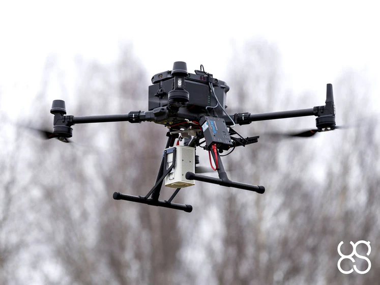
SPH Engineering’s methane-detection ecosystem — delivered in the UK through their partnership with JBUAS — provides a safer, faster and more accurate way to monitor industrial sites using automated UAV platforms. By combining SPH Engineering’s laser-based gas sensors, the SkyHub onboard computer and the UgCS mission-planning software, organisations can replace slow manual inspections with precise airborne surveys that strengthen compliance and reduce environmental risk.
Why Methane Monitoring Matters for UK Industry
Industrial operators across the UK face strict regulatory demands to identify, quantify and reduce methane releases. Traditional ground-based inspections often fall short: handheld detectors require technicians to walk hazardous terrain, coverage is limited, and results can be inconsistent.
Methane emissions can be dangerous for operations at UK industrial facilities and pipeline networks… ground crews often have to walk dangerous
sites with handheld detectors.
Airborne methane detection solves these problems by allowing sensors to scan large assets from a safe distance, delivering real-time data without exposing personnel to risk.
How SPH Engineering’s Methane-Detection Workflow Operates
SPH Engineering’s methane-detection payload uses tunable diode laser absorption spectroscopy (TDLAS) to measure methane concentrations with high sensitivity. The sensor directs a laser beam towards the ground and analyses reflected wavelengths to determine gas density in real time.
High-Sensitivity Plume Mapping
High-frequency sampling identifies faint leaks before they escalate into major hazards. Operators can generate detailed heatmaps showing plume origins, intensity and spread — ideal for regulatory reporting and maintenance planning.
In a typical mission, a rectangular survey area is overlaid with colour-graded concentrations — green for background levels, yellow for elevated readings, and red for peak methane emissions — giving a clear visual of where leaks originate and how they disperse across a landfill or industrial zone.
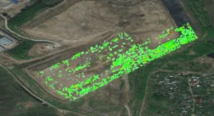
Methane Plume data visualisation
SkyHub: Secure, Synchronous Data Collection
SkyHub acts as the central processing unit for SPH Engineering payloads. It synchronises raw gas measurements with drone telemetry, timestamps each reading and storing all mission data offline, ensuring full operator control.
SkyHub enables sensor integration, telemetry synchronisation and secure mission data collection. All mission data is recorded offline in standard formats such as CSV, SEG-Y and NMEA-0183.
This offline-first design supports UK organisations that must comply with strict confidentiality and data-handling requirements.
Learn more about SkyHub’s secure data workflow in our SkyHub data security overview.
UgCS Mission Planning for Industrial Sites
UgCS provides automated flight-path planning, terrain-following profiles and corridor-mapping tools. Operators can import elevation models, configure lawnmower grids and programme long linear missions along pipeline routes. This ensures consistent coverage and accurate data capture across complex industrial environments.
Traditional vs Modern Methane Inspection Methods
| Inspection Method | Coverage Speed | Safety Level | Target Applications |
|---|---|---|---|
| Handheld sniffers | Low | Medium | Ground point testing |
| Optical gas imaging | Medium | Medium | Local valve checks |
| Airborne UAV mappers | High | High | Wide site surveys |
Airborne systems deliver faster coverage, higher safety and more consistent results than traditional ground-based methods.
Key UK Industrial Applications
Landfill Gas Monitoring
Landfills continuously release methane due to organic waste decomposition. UAV-mounted sensors map entire landfill surfaces, detect leaks and support Environment Agency audits.
Capping Layer Inspections
Drones fly low over capped landfill cells to identify cracks or liner failures, enabling rapid repairs and maintaining containment.
Off-Gas Extraction System Audits
Airborne monitoring identifies pressure drops caused by loose fittings or damaged lines, improving gas-to-energy recovery.
Pipeline Integrity Surveys
UgCS supports long corridor missions along buried trunk lines, allowing drones to autonomously follow pipeline paths and log gas concentrations.
Remote Valve Station Checks
Airborne inspections remove the need for long ground journeys to isolated infrastructure, reducing time on site and improving safety.
Supported UAV Platforms
| UAV Platform | Max Flight Time | Payload Capacity | Ideal Environment |
|---|---|---|---|
| DJI Matrice 300 RTK | 55 min | 2.7 kg | Industrial sites |
| DJI Matrice 350 RTK | 55 min | 2.7 kg | All-weather surveys |
| DJI Matrice 400 | Extended | Heavy lift | Multi-sensor flights |
Falcon Plus TDLAS methane detector
Why UK Organisations Choose JBUAS
As SPH Engineering’s UK integration partner, JBUAS delivers fully configured methane-detection platforms, complete with SkyHub, UgCS and laser-based sensors.
JBUAS provides hardware integration, with hands-on testing at our dedicated facility in the UK.
Local Technical Expertise
JBUAS configures payloads, updates firmware, calibrates sensors and ensures every system is ready for immediate deployment.
UK Geophysical Test & Training Centre
The 7,500 m² test site allows clients to trial methane sensors, GPR, magnetometers and multisensor workflows under realistic conditions.
Hands-On Demonstrations and Training
Operators receive practical mission-planning guidance, safety training and real-time data-stream demonstrations.
Explore SPH Engineering’s Methane-Detection Tools.
For full technical specifications and sensor options, you can explore SPH Engineering’s dedicated methane-detection product range on their website.
Learn More About SPH Engineering UAV Geophysics
For a wider look at SPH Engineering’s sensor ecosystem and how JBUAS supports UK operators, visit our SPH Engineering UAV geophysics article.
Final Thoughts
SPH Engineering’s methane-detection ecosystem — delivered and supported locally by JBUAS — gives UK industries a modern, safe and highly accurate method for monitoring emissions. Automated UAV surveys reduce operational risk, strengthen compliance and provide the detailed data needed to protect both facilities and the environment.
Frequently Asked Questions (FAQs)
-
What is the maximum standoff distance for SPH Engineering laser sensors to detect methane?
SPH Engineering TDLAS laser sensors reliably detect methane columns. The accuracy is maintained even from standoff distances between 10 and 80 metres. This elevation enables operators to inspect pressurised assets and hazardous industrial structures. All of this is maintained while the drone craft and the ground pilots are kept at a safe distance outside the dangerous vapour zones.
-
How fast can a UAV methane survey team cover a large facility when compared to ground crews?
A single UAV mapping flight can cover up to 50 hectares in a day or scan long pipeline corridors at speeds up to 30 m/s (108 km/h). Thorough site inspections can be completed up to five times faster than by manual crews using handheld devices.
-
What are the correct file formats for GIS reporting and compliance with regulations?
Raw telemetry and concentration logs are processed using DroneGIS and UgCS. Data is output as industry-standard formats. The standard file formats include CSV, KML/KMZ, and report-ready PDFs. These structured exports ensure compliance under the EU 2024/1787 and the UK Environment Agency mandates.
-
Can the SPH Engineering methane detection system operate effectively in wet or windy British weather?
The DJI Matrice 350 RTK is IP55-rated. When mounted on such platforms, the system can handle light precipitation and operational winds up to 12 m/s. The onboard SkyHub controller maintains consistent data logging across temperatures. Such temperatures often range from -20°C to 50°C.
-
Does JBUAS offer calibration and servicing after purchase? Does it also offer sensor re-certification in the UK?
Yes. JBUAS provides complete UK-based post-sale lifecycle support. This support includes hardware maintenance, firmware updates and optical re-calibrations. The support also includes replacement parts directly from their Nottinghamshire facility. This eliminates the need to ship equipment back to continental Europe.
Related Reading (Cluster Articles)
- What is SPH Engineering’s SkyHub, and how does it work?
- SPH Engineering UgCS for UK surveyors — complete guide
- SPH Engineering methane detection: UK industrial applications
- Why SPH Engineering chose JBUAS as its UK partner
- How JBUAS and SPH Engineering Are Transforming UAV-Based Geophysics in the UK
- How SPH Engineering’s TTF Radar Enables Safe Low‑Altitude UAV Flight