


For many survey companies, drone operators and engineering consultancies, the biggest challenge is not purchasing new equipment. It is understanding how different technologies work together, validating workflows before deployment, and gaining the confidence to deliver specialist geophysical services safely and effectively.
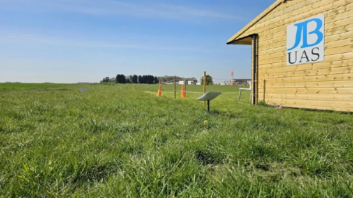
That is precisely why JBUAS established their UK Test & Training Centre (TTC), which is dedicated to UAV geophysical sensor systems. JBUAS focuses on enabling customers to expand their own capabilities through specialist sensor integration, training and technical support.
This article is part of our internal resources about SPH Engineering’s integrated sensor capabilities:
Inside the UK’s Only UAV Geophysical Test Site → SHP Integrated Drone Systems
A Different Approach to UAV Geophysics
Many organisations are already highly experienced in drone surveying. They routinely use photogrammetry and LiDAR to capture topographic, engineering and mapping data.
What often proves more challenging is introducing specialist sensor technologies such as:
- Ground Penetrating Radar (GPR)
- Magnetometers
- Methane detection sensors
- Sonar and bathymetry systems
- Gamma-ray spectroscopy equipment
- Echo sounding technology.
This is where JBUAS specialises.
Customers already understand traditional drone mapping technologies. What they often need is support integrating advanced geophysical sensors into existing workflows through specialist equipment, training and operational guidance. JBUAS helps bridge this gap through system integration, training and technical support. At the TTC, customers benefit from expert tuition and hands-on practical experience of flying different payloads over various terrains.
Why a Dedicated Test Centre Matters
Integrating a geophysical sensor onto a UAV involves far more than attaching a payload and taking off.
Survey operators need to understand:
- Sensor configuration
- Flight planning
- Terrain-following operations
- Data capture requirements
- System limitations
- Operational safety considerations
- Processing and interpretation workflows.
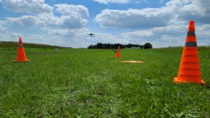
Low-flying practice at the TTC
The JBUAS Test & Training Centre provides a controlled environment where customers can evaluate technologies before committing to operational deployment. Rather than learning during a live client project, operators can gain practical experience with integrated systems under real-world conditions.
Powered by SPH Engineering Integrated Systems
At the centre of many workflows demonstrated at the facility are integrated solutions from SPH Engineering.
SPH Engineering has developed an ecosystem specifically for professional UAV geophysical operations, combining:
- UgCS mission planning software
- SkyHub onboard control systems
- True Terrain Following (TTF) technology
- Specialist sensor integrations
- Automated data collection workflows.
These technologies enable drone operators to deploy advanced geophysical payloads with greater confidence and consistency. The result is not simply a collection of components but an integrated operational workflow that supports applications ranging from utility detection and methane monitoring to magnetometry, bathymetry and subsurface mapping.
More Than Demonstrations
The purpose of the Test and Training Centre is not simply to showcase equipment.
It is designed to help organisations answer practical questions such as:
- Which sensor technology is most appropriate for a specific project?
- How should an integrated system be configured?
- What training is required before deployment?
- How does terrain-following impact data collection?
- How can geophysical data be combined with GIS, LiDAR and photogrammetry datasets?
These are the types of questions that survey companies frequently encounter when expanding their service offerings. JBUAS helps survey companies add specialist geophysical sensing capabilities to the services they already provide, enabling them to broaden their offering without having to develop everything from scratch.
Supporting Survey Providers Rather Than Replacing Them
A common misconception is that specialist system providers also deliver survey services.
JBUAS takes a different approach.
The company focuses on supplying, integrating and supporting geophysical sensor systems while enabling customers to carry out the surveys themselves. Whether a customer is looking to deploy drone GPR, drone magnetometry, methane detection or bathymetry systems, JBUAS provides the technology, integration expertise and training required to get operational.
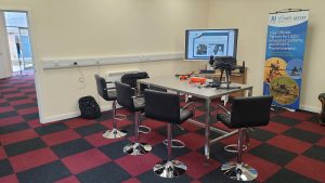
In-person tuition from qualified experts
The goal is simple: JBUAS enables survey companies, contractors and drone operators to expand their capabilities through advanced geophysical sensor technology rather than compete with them for survey work.
A Place to Learn, Test and Validate
The applications explored at the Test and Training Centre reflect the growing demand for UAV geophysical sensing across multiple sectors.
Examples include:
- Pipeline detection
- Methane monitoring
- UXO and unexploded ordnance investigations
- River and lake surveys
- Bathymetric mapping
- Subsurface investigations
- Utility detection
- Environmental assessments.
By providing access to real equipment, practical demonstrations and structured training, the centre helps organisations move beyond theory and understand how these technologies can support commercial projects.
Where Traditional Survey Technologies Still Fit
Geophysical sensors do not replace photogrammetry or LiDAR. Instead, they complement them. Photogrammetry can provide detailed visual models of a site. LiDAR can assist with terrain modelling and obstacle identification. Specialist sensors then add the critical layer of information that cannot be seen from the surface.
For example:
- LiDAR can support flight planning and terrain analysis
- Photogrammetry can provide a geo-referenced site model
- GPR, magnetometers and methane sensors provide the underlying geophysical data.
This integrated approach enables survey providers to extract more value from the data they collect while offering additional specialist services to their customers.
Building Confidence Before Deployment
For many organisations, adopting UAV geophysical technologies represents a significant investment in both equipment and training. The test centre allows operators to explore different sensor technologies and understand integration requirements. By growing their knowledge and skills, customers build operational confidence and develop the ability to assess which technologies are best suited for their needs.
This helps reduce risk and ensures systems are deployed effectively from day one.
Looking Beyond Hardware
The most successful UAV geophysical projects rely on much more than hardware alone.
They require:
- Correct system integration
- Appropriate flight planning
- Operator training
- Technical support
- Workflow development
- Ongoing operational guidance.
By combining these elements, JBUAS helps customers transform specialist technologies into practical operational capabilities.
Conclusion
JBUAS’s Test and Training Centre is about far more than equipment demonstrations. It exists to help survey providers, engineering consultants and drone operators understand how integrated geophysical sensor technologies can enhance the services they already deliver.
Powered by SPH Engineering systems and supported by practical training and technical expertise, the facility provides a unique environment for evaluating technologies, validating workflows and developing operational confidence.
As a systems integrator, distributor and training provider, JBUAS focuses on enabling customers to expand their own geophysical survey capabilities, helping them move beyond traditional mapping towards specialist sensing applications.
Ready to Add Geophysical Sensing to Your Operations?
Whether you’re exploring drone GPR, magnetometry, methane detection or bathymetry, JBUAS can help you evaluate the right technology, understand integration requirements and build the skills needed for successful deployment.
Visit the JBUAS Test & Training Centre to experience integrated SPH Engineering systems first-hand and discover how advanced geophysical sensors can complement your existing survey services.
Book a Visit or Speak to Our Team
Related Reading (Cluster Articles)
- What is SPH Engineering’s SkyHub, and how does it work?
- SPH Engineering UgCS for UK surveyors — complete guide
- SPH Engineering GPR vs traditional ground GPR workflows
- SPH Engineering methane detection: UK industrial applications
- Why SPH Engineering chose JBUAS as its UK partner
- How JBUAS and SPH Engineering Are Transforming UAV-Based Geophysics in the UK