


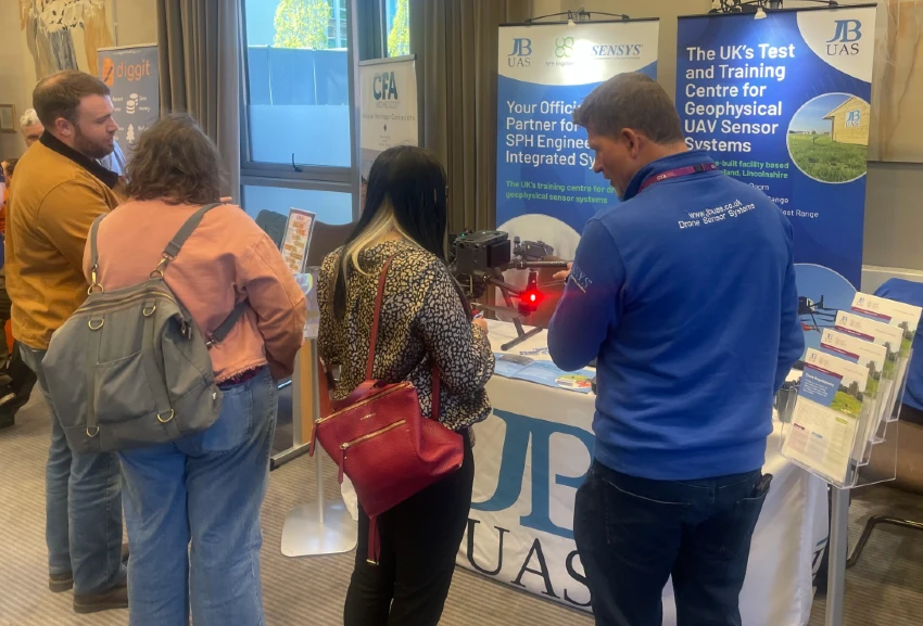
JBUAS showcased its latest drone archaeology survey technology at the Chartered Institute for Archaeologists (CIfA) Conference 2026, demonstrating how UAV-mounted magnetometers can improve the speed, safety and efficiency of archaeological geophysical surveys.
The conference provided an excellent opportunity to discuss developments in archaeological practice, exchange ideas with industry specialists and explore how emerging technologies are supporting more efficient and sustainable survey methodologies. It also enabled the JBUAS team to strengthen relationships across the sector and gain valuable insight into the evolving needs of archaeological organisations.
What is Drone Magnetometry?
Drone magnetometry is an advanced geophysical survey technique that combines unmanned aerial vehicles (UAVs) with highly sensitive magnetic sensors to detect subtle variations in the Earth’s magnetic field. These variations can reveal buried archaeological features such as ditches, walls, kilns and other structures without disturbing the ground.
Compared with traditional hand-held surveys, UAV magnetometry can cover significantly larger areas in less time, improve operator safety and deliver consistent, high-resolution datasets, even across challenging or inaccessible terrain. This makes it a valuable tool for archaeological site evaluation, heritage management and non-invasive investigations.
Demonstrating UAV Magnetometer Surveys
JBUAS attended the CIfA Conference to demonstrate how drone survey technology can complement established archaeological survey methods through faster and more efficient data collection. At the event, the team showcased the DJI Matrice 300 RTK equipped with the MagNIMBUS atomic total-field magnetometer from SPH Engineering. The lightweight UAV-mounted system is designed to collect survey-grade magnetic data while reducing the time, cost and logistical challenges often associated with conventional ground-based surveys.
The technology generated significant interest among delegates, leading to discussions about how drone magnetometer surveys can help archaeological professionals gather high-resolution geophysical data across large sites in a fraction of the time required by traditional methods.
Supporting Better Archaeological Decision-Making
By enabling rapid, non-invasive mapping of extensive areas, UAV-based geophysical surveys provide valuable information during site evaluation, heritage management and excavation planning. The ability to collect accurate data efficiently allows project teams to make informed decisions earlier in the investigation process while reducing disruption on site.
JBUAS works closely with archaeologists, consultants and heritage professionals to integrate advanced UAV technology into existing survey workflows, providing practical solutions for faster, safer and more efficient archaeological investigations.
Conclusion
As archaeological projects continue to seek faster, safer and more sustainable methods of non-invasive archaeological survey methods, UAV-mounted geophysical surveying is becoming an increasingly important tool for heritage professionals. JBUAS remains committed to helping archaeology professionals adopt these technologies through specialist equipment, technical expertise and practical field support.