


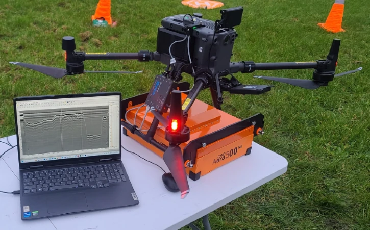
JBUAS Supports University GPR Development
JBUAS is partnering with a leading university to develop an integrated Mag/GPR/Camera system for detecting UXO. The project team hopes to deploy the system in Ukraine and other regions experiencing conflict.
The project’s lead professor and PhD students visited the JBUAS Test Centre to collect sample data. They surveyed various zones across the JBUAS test range to support their GPR development. A highlight of the visit was the arrival of a compact autonomous buggy that was actively collecting data across the test range. This was no ordinary buggy. The vehicle carried the latest sensors and a compact onboard computer system. This computer records all the different data sets and then fuses them together for the AI to do its work.
The AI learns to recognise UXO signatures and distinguish them from non-hazardous objects. As it processes additional datasets, the system continually improves its accuracy and reliability. This is very clever, as it gets better every time it sees a new data set… better and better and better and better and…
A New AI Future
According to Simon Navin (MRICS), “For many years, surveyors have relied on instrumentation they operate to collect and manage data in the field, such as total stations, GPS receivers and laser scanners. Even though these instruments and systems have become more sophisticated and increasingly automated, they still rely on human set-up and operation. Furthermore, remote-sensed spatial data, including aerial and satellite imagery, has reduced the need for some fieldwork. Surveyors can now assess vegetation encroachment and ownership extents through desktop GIS analysis.
These technologies allow for determination of client requirements and impacts at scale and the ability to create automated routines and classification, saving time and improving accuracy in many cases. While these methods are effective, they still require an element of labour-intensive human resources, which can be time-consuming and prone to human error. Enter AI, which offers opportunities to streamline surveying operations, provide location intelligence, improve accuracy and enhance decision-making processes. “See here, AI is transforming our approach to solving complex issues: AI Future
For more information on our airborne sensors, click below:
University AI-driven System
This technology will be available soon, so follow our progress as we work with the university to deliver the final project.
To find out how we can support your R&D, get in touch.