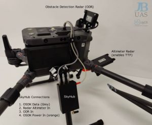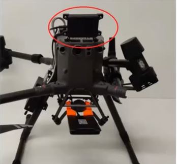
We are pleased to launch the new forward-facing UgCS Obstacle Detection Radar (ODR) for the DJI M300RTK. The ODR works with the exisitng UgCS radar altimeter on the M300 RTK to provide users with extra piece of mind when flying geophysical sensor missions.
The UgCS Obstacle Detection Radar (ODR) is a new addition to UgCS SkyHub’s list of supported sensors and like the radar altimeter, has an easy, quick connection. This system can be used with True Terrain-Following or TTF mode (when the radar altimeter is used to ensure a constant elevation over the ground), and in normal autopilot missions. This UgCS Obstacle Detection Radar (ODR) is also extremely useful for magnetic surveys when digital elevation models (DEM) are used for mission planning, where the possibility to catch the edges of tree branches or parts of other pretruding features, remains a risk.
Magnetic Surveys: The magnetometer is used from magnetic surveys and it is not an active sensor. It measures the magnetic field at the point where it is located. So for the detection of objects (especially small ones), it is very important to fly as close to the surface as possible. The true terrain-following system with a precise laser altimeter allows flying as low as 1m AGL. Using a magnetometer on a drone enables us to scan the area and detect metals several times faster compared with handheld devices and allows obtaining geo-referenced maps of the area. One of the main components of the integrated system, enabling efficient survey planning is UgCS – flight planning software providing tools for easy creation and calculation of flight paths, and interpretation of acquired data in a user-friendly manner.
For more information, get in touch.